Mapping Potential Superblock Locations
Project StoryMap
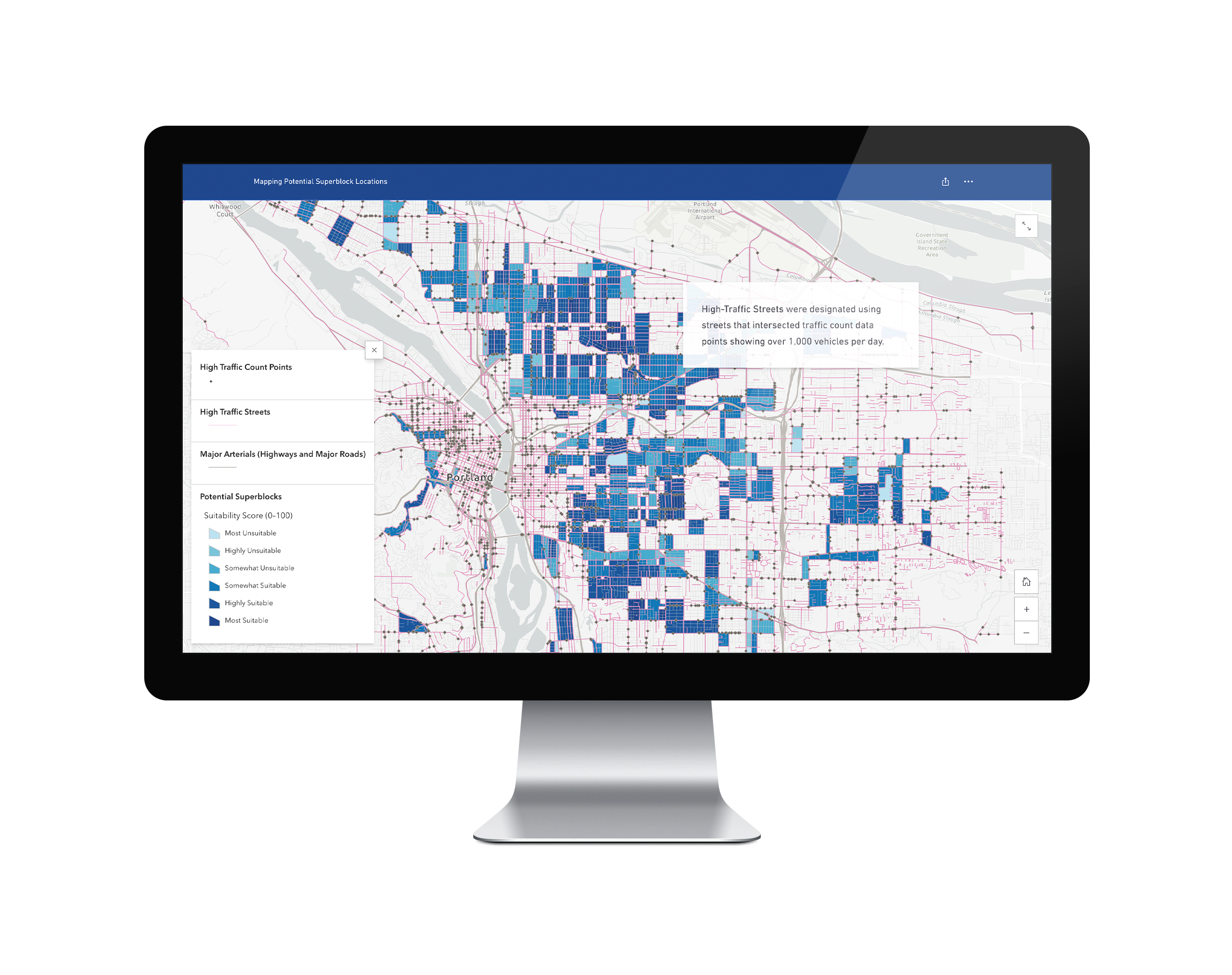
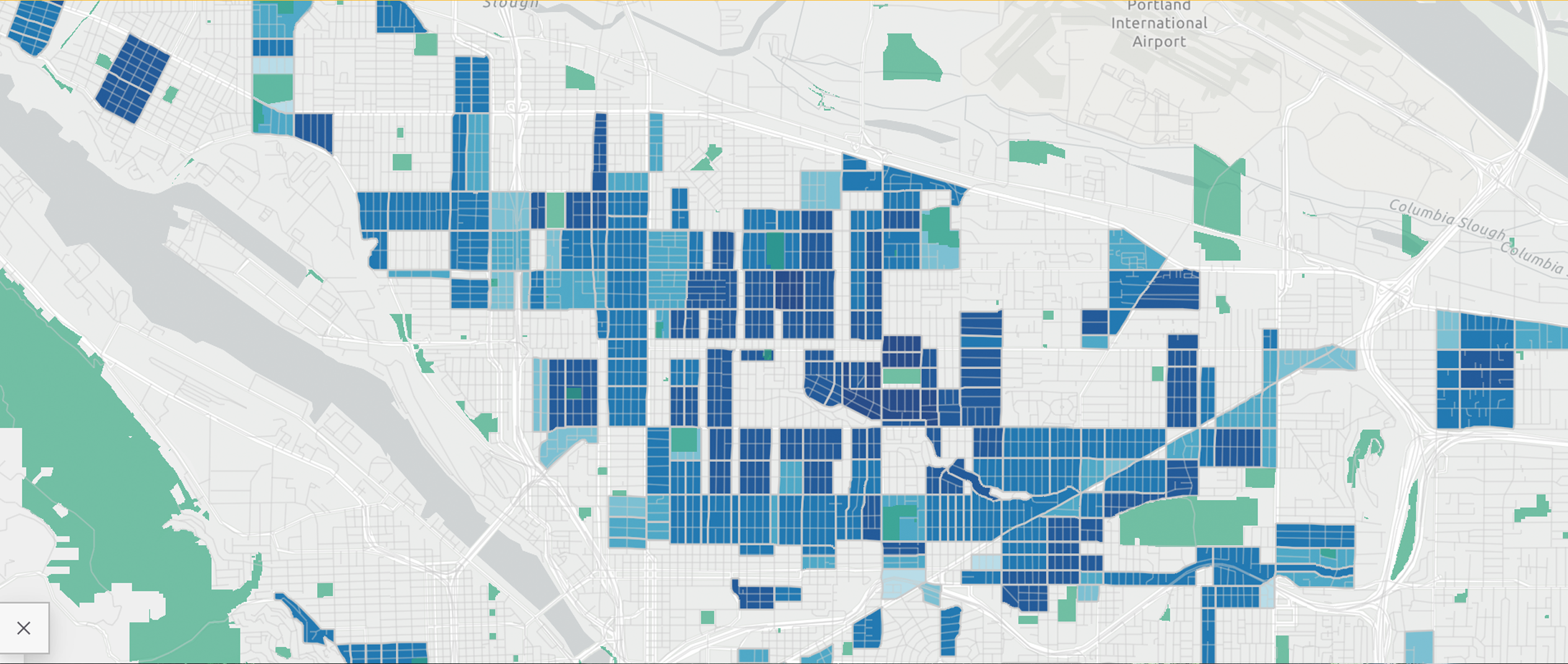
This project uses ArcGIS and data from Oregon Metro RLIS and the City of Portland Open Data to analyze potential locations to develop superblocks in Portland, OR. The project used a variety of metrics based on proximity to essential features and distance from high traffic roads to determine optimal locations. Click through to the StoryMap to view the analysis and findings.